Google Earth’s Community Is a Habit of Looking Together

Open Google Earth to find one place and you may stay for an hour, following coastlines, circling mountain ranges, or dropping into a street you once called home. The app’s community is less a club than a habit of looking together: people make places legible through stories, photos, shared searches and links sent to someone who knows the view. That loose participation gives the globe its human pull, though it also means the social layer can feel scattered and hard to join.
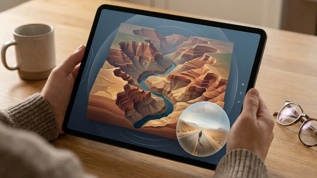
At its core, Google Earth is a way to explore a three-dimensional model of the planet, moving from a planetary view down to satellite imagery, terrain and, where available, Street View imagery. Its community does not operate like a conventional social network with a central feed, public profiles and a steady stream of posts. Instead, the app’s most social act is often simple: find a place, then pass the view to another person.

Google Earth
Google LLC3.8Travel & Local
See More Apps Related to Google Earth


The pleasure of contributing a point of view
That distinction matters. People do not need to publish regularly or gather followers to make the product useful to others. A link to a particular landscape, an explanation of how a neighborhood has changed, or a comparison between an old mental map and a new image can turn exploration into a shared activity. The audience may be one friend, a family group, a classroom or a larger online community discussing geography.
Google Earth works best socially when it becomes a common reference point, not when it tries to imitate a social platform. A view from above can settle a practical question about where a river bends, prompt a story about a migration, or make a distant destination feel concrete before a trip. The app supplies the shared surface; people provide the meaning.
A participation model without a single gathering place
Participation is broad but uneven. Some users explore privately, treating the globe as an atlas that answers questions on demand. Others use it to prepare lessons, explain local history, plan a route or build a narrative around a location. Google’s Voyager feature has offered curated stories and guided tours, giving exploration a more authored shape. The exact mix of features can change across versions and devices, so it is safer to think of these as possible modes of engagement rather than a guaranteed community toolkit in every mobile build.
That range is a strength: there is no required posting schedule, creator identity or public performance. It is also the source of the app’s social weakness. Contributions are spread across shared links, classes, websites, videos and conversations elsewhere. A newcomer can enter the globe immediately, but may not know where to find the people who are already using it well.
The mobile app makes the first step intuitive. Search for a place, zoom in, rotate the view and follow curiosity. The transition from a map-like overview to terrain and close-up imagery gives beginners a satisfying sense of discovery without demanding specialist knowledge. Street View, where available, can turn a distant pin into a street-level visit. A useful link from a friend or teacher is often a better introduction than a formal tutorial because it arrives with a reason to look.
Worth Reading Next

OpenTable’s OS Update Makes Booking Smoother, but Search Still Leads

Cash App by Use Case: Who Should Trust It With Their Money?
Clash of Clans Makes Every Raid the Start of a New Plan

Stickman Warriors Is Built for Quick Fights, Not Deep Competition

Downloader’s One-Tap Promise Comes With Real Limits
More From Our News Desk
View All

Still, exploration can be disorienting. The sheer scale invites aimless roaming, and satellite imagery is not a live window onto the world. Coverage and image dates vary, details differ by location, and a striking view may be older than a newcomer assumes. People who arrive expecting current conditions, comprehensive street-level imagery or an always-obvious route from curiosity to insight can hit a boundary quickly.
Rituals of return
The recurring rituals are personal rather than platform-driven. Users revisit a childhood home, check a place they plan to travel, compare landmarks, or follow a question from one region to another. Families can use the globe to locate a relative’s town; teachers can build a lesson around a watershed or a city’s growth; a curious user can trace a coastline simply because its shape catches the eye. These sessions do not necessarily create a visible public record, but they give the app a durable place in people’s routines.
There is a particular pleasure in returning to a familiar location and seeing it from a new angle. Zooming out changes an individual street into part of a larger pattern; tilting the view brings hills and valleys into relief. That shift in scale is the app’s social rhythm, too. One person points to a detail, another widens the frame, and a conversation moves between intimate memory and geographic context.
Creators extend that rhythm beyond the app. Educators, travel writers, researchers and video makers can use Google Earth imagery or guided exploration as part of a larger story, subject to the applicable product and imagery terms. The contribution may be a carefully sequenced tour, a classroom demonstration or an explanatory video rather than a post inside a shared Earth community. These creators lend the globe context and narrative, while Google supplies the underlying visual material and navigation.
This arrangement is productive, but it complicates the idea of community ownership. The app enables exploration; it does not make every user a map editor or give every local observer a direct route to correct what an image suggests. Satellite views can make a place look like neutral evidence, even when image timing, resolution, angle and missing context shape what viewers see. A creator’s explanation can correct that impression, but the explanation is often hosted somewhere else.
Friction, trust and moderation
Social friction tends to arrive through interpretation. A screenshot or shared view can be used to tell a thoughtful story, but it can also be presented as current proof when it is not. People may disagree about borders, place names, development or the meaning of a landscape. Aerial imagery can reveal sensitive locations and, depending on detail and availability, raise privacy concerns. The app’s perspective feels expansive, yet the people and histories beneath it are not always visible.
Moderation is difficult to assess as a single community system because participation is distributed. Google provides policies and reporting mechanisms for its products and user-submitted content, but a link passed around in a private chat, a third-party video and an educator’s tour do not share one universal moderation context. Users should not assume that every discussion connected to the app is reviewed, that every disputed claim will be corrected, or that every community-made explanation has been independently verified.
That uncertainty is not a reason to avoid sharing. It is a reason to share carefully. Explain what a view can and cannot establish, be cautious about exposing private homes or vulnerable locations, and check dates and context before treating imagery as a record of present conditions. The app’s visual authority can make a claim look more certain than it is, so responsible creators need to supply the caveats the image cannot.
Network value appears most clearly when the globe saves several people from describing the same place from scratch. A teacher can anchor a discussion in a landscape; a traveler can show companions the shape of a destination; a family can put a distant hometown in view. In each case, the value grows with the number of people who understand the reference, but it does not depend on all of them being active contributors. A single carefully chosen view can serve a whole group.
That is a different kind of network effect from the one Google Home depends on, where shared devices and household routines can make participation feel ongoing. Google Earth’s value is less about maintaining a connected group than about making a place easier to discuss. It also differs from Google Classroom, where structured assignments and teacher-led participation give a group a defined meeting point. Earth can support such uses, but it rarely supplies the social structure by itself.
Can this ecosystem last?
The ecosystem’s durability comes from the planet’s endless supply of questions. A changed coastline, a new city district, a place in a family story or an unfamiliar mountain range can all bring someone back. Better imagery, new guided material and creators who know how to tell a grounded story can renew interest. The globe is a durable canvas because its subject does not run out.
Its limits are just as durable. Community activity remains fragmented, and the app does not make the full path from discovery to discussion especially visible. It can be hard to tell which shared tours or stories are current, who created them, or whether a useful contribution is meant for a broad audience or a small group. If the imagery is old or the content is hard to find, even a compelling exploration can end as a private detour rather than a lasting exchange.
That makes the community less fragile than a trend-driven feed, but also less cohesive than a platform designed around creators and conversation. Google Earth does not need constant posting to remain useful. It does need clear context, dependable access and people willing to turn a compelling view into a responsible explanation. Those conditions are partly in Google’s hands and partly beyond them.
The best way into the ecosystem is to bring a question, not an expectation of social features. Search for the place you want to understand, explore it at more than one scale, and share a specific view with someone who can add context. If a guided story helps, follow it; if an image raises a serious claim, check its age and source before repeating it. That modest approach suits the product better than treating every discovery as content to publish.
Google Earth earns its community value by giving people a common view of places they could otherwise only describe. Its users, teachers and creators add memory and explanation, but the network remains dispersed, and moderation cannot be assumed to follow every conversation beyond the app. The verdict is warm but measured: this is an unusually powerful tool for shared curiosity, not a fully formed social community. Its strongest feature is still the simplest one—putting the world in view so another person can look with you.